
Why CODs exist
In emergencies, many organizations provide relief, each in its own way, and each collects information as the response goes on: needs assessments, where partners are working, how many people have been reached. Sharing this information is how needs get identified and how gaps and duplication in assistance are avoided. It only works if every organization refers to places in the same way.
CODs give partners that common reference. When UN agencies, NGOs, the Red Cross and Red Crescent, and governments use the same boundaries and population figures, their data can be compared and combined. In each country, the Information Management Working Group, made up of information managers from government, UN agencies, clusters and NGOs, adopts the CODs as the standard.
Preparedness
Decisions in the first hours and days of an emergency rely on data that already exists, so the work of gathering, managing and sharing it has to happen before a crisis. For sudden-onset emergencies, current guidance calls for CODs to be shared within 48 hours. That leaves time to check and correct them, but not to build them. If CODs have been kept up to date, the corrections are small.
- BeforeCODs are kept up to date
- Day 0The emergency starts
- Within 48 hoursCODs are shared, then checked and corrected
- ResponseAssessments, maps and the 3W use the CODs
P-codes
Linking datasets by place name causes errors. Sources spell names differently, or use another language: the Madagascar COD-AB has Amoron I Mania and Haute Matsiatra, where OpenStreetMap has Amoron’i Mania and Matsiatra Ambony. Names also repeat. In Madagascar, 81 different administrative level 4 units are called Morafeno.
A P-code (place code) identifies one administrative unit. It starts with the country’s ISO3 code and adds a three-digit number for each level below, separated by dots. Units that share a name, like the commune of Morafeno and the fokontany inside it, still get different codes.
MDGMadagascarMDG.011Analamanga regionMDG.011.1181st arrondissement of Antananarivo, the capital
Datasets that use the same P-codes can be joined directly, without matching names by hand. Each COD-AB includes a gazetteer listing every P-code with its name. The P-code format in the Standards gives the full rules.
MDG.021MDG.021MDG.022MDG.022How CODs are used
COD-AB and COD-PS are used in every phase of the humanitarian programme cycle:
- MapsBase layers for every map
- AssessmentsData collected by P-code
- AnalysisAffected population, from COD-AB and COD-PS
- CoordinationThe Humanitarian Needs Overview and the 3W
The maps below link the two. Each COD-PS figure is attached to its COD-AB boundary by P-code, which is enough to show where people live and how age and sex vary.
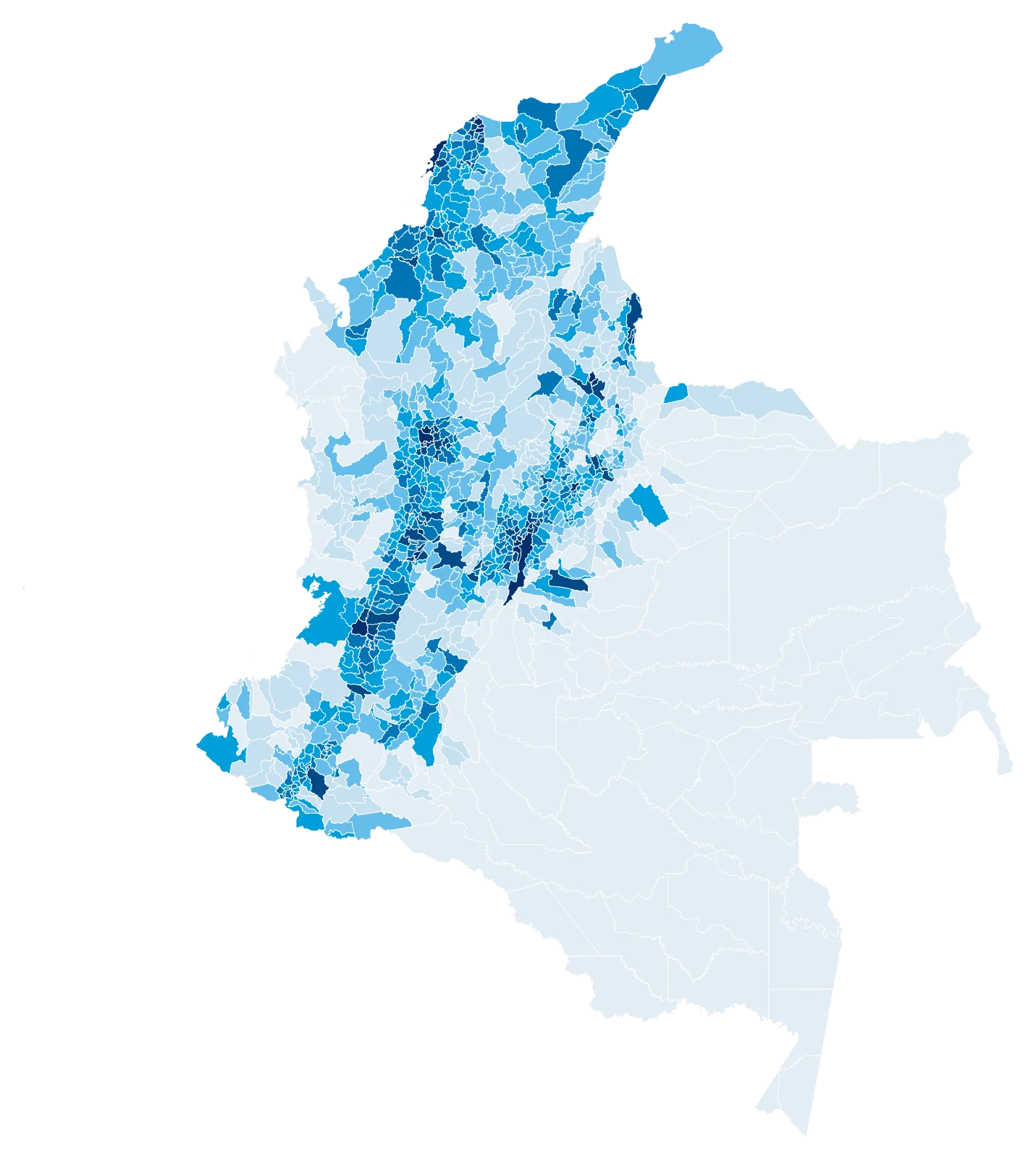
- under 10
- 10 to 25
- 25 to 50
- 50 to 100
- 100 to 300
- 300 to 1,500
- 1,500 and over
- people per km², average over each unit
COD-PS population estimates joined to COD-AB administrative level 2 boundaries by P-code, for Colombia, Zimbabwe and Namibia, where every unit has a figure broken down by age and sex. Most COD-PS figures are projections from the last census, and in many countries they are published only at a higher level or use P-codes from an older version of the boundaries. Sources: COD-AB, COD-PS.
The boundaries and names shown and the designations used on this map do not imply official endorsement or acceptance by the United Nations.