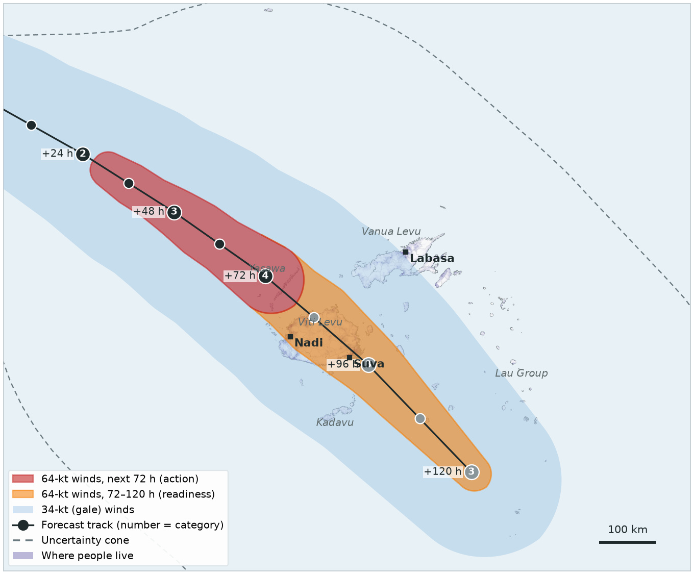
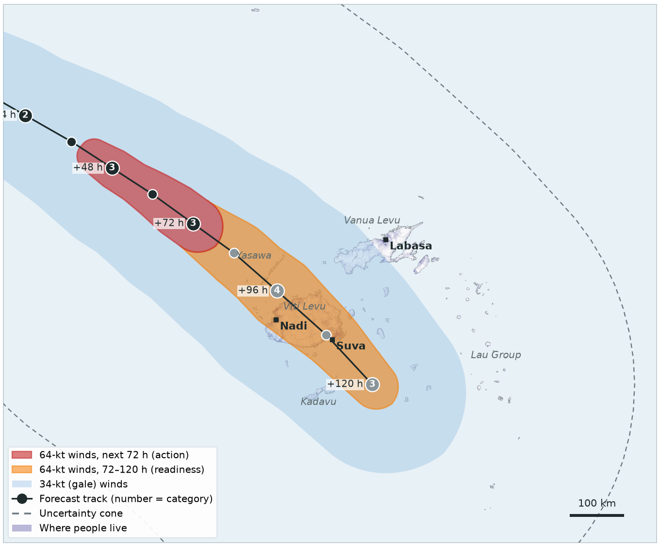
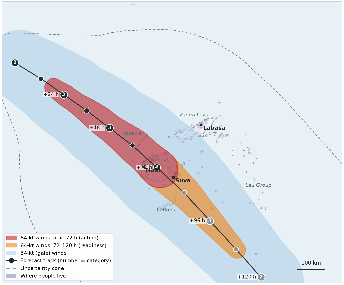
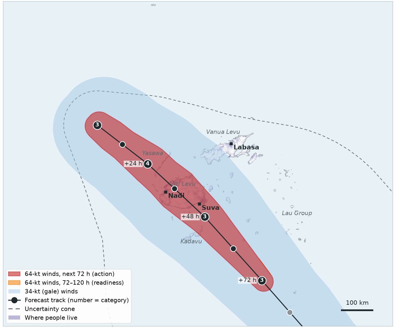
Each slide is one forecast
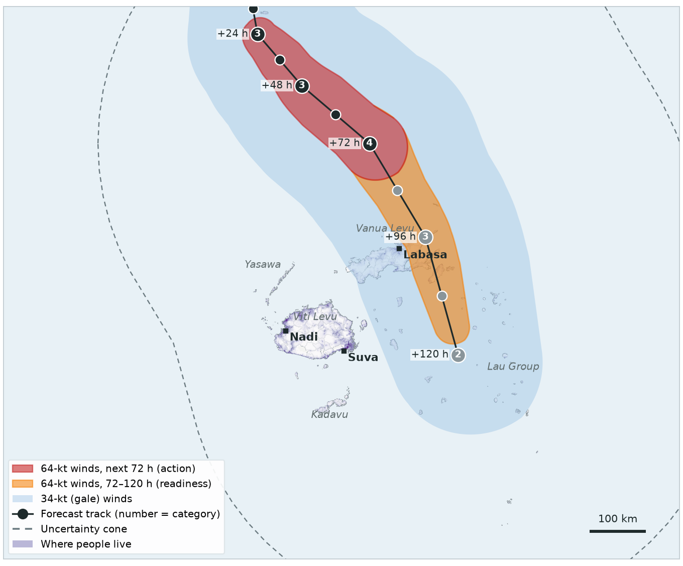
- Red: 64-kt winds in the next 72 hours — counts for action (and readiness).
- Orange: 64-kt winds 72 to 120 hours ahead — counts for readiness only.
- Light blue: gale-force (34-kt) winds — shown for context, not part of the trigger.
- Dots: forecast position every 12 hours (black up to 72 h, grey after); the number is the category.
- Purple: where people live. The trigger counts the people under the red and orange zones.
- Dashed line: uncertainty cone — for information only, the trigger uses the forecast track.
| Status in the table | |
|---|---|
| Not reached | below the threshold |
| ACTIVATED | activates on this forecast |
| ✓ ActivatedDay 1 | activated earlier |
RSMC Nadi issues its first forecast for Cyclone Alpha, west of Vanuatu. It is forecast to reach only Category 2: no hurricane-force (64-kt) winds anywhere, so nobody is in the red or orange zone.
| Trigger | This forecast | Status |
|---|---|---|
| Readiness120-hour forecast |
0 people in 64-kt zone
threshold 5,000
|
Not reached |
| Action72-hour forecast |
0 people in 64-kt zone
threshold 5,000
|
Not reached |
| Observational2-day rainfall | IMERG satellite, checked daily | — |
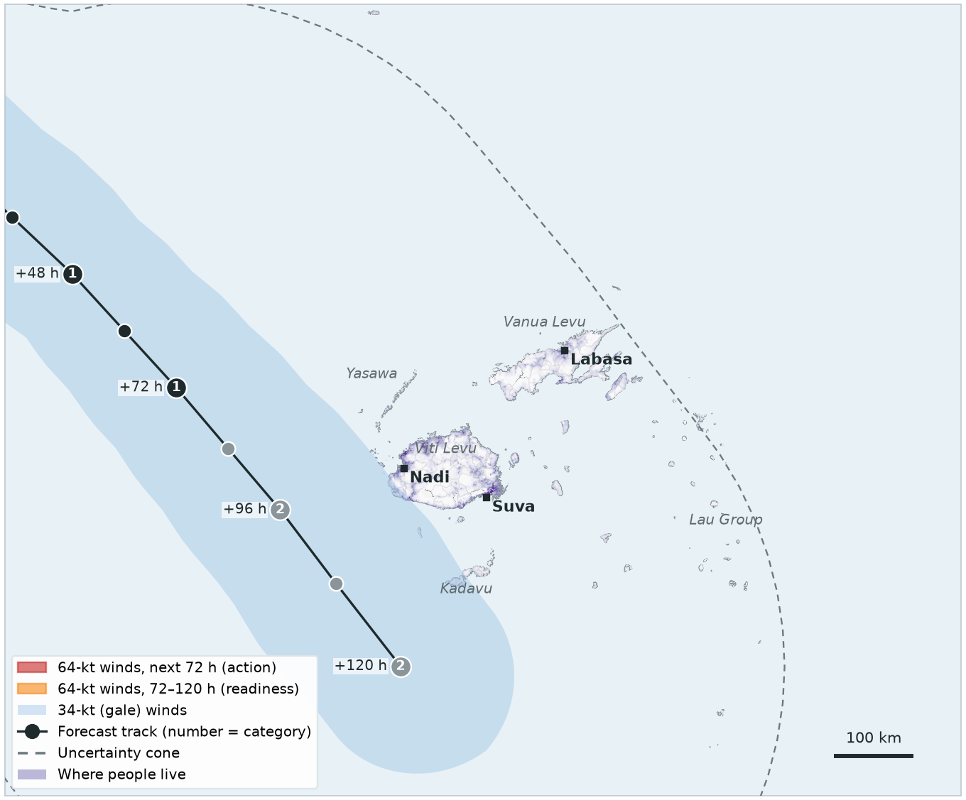
Alpha is now forecast to become a Category 4 cyclone and cross Viti Levu in about four days. 649,967 people are in the 64-kt zone of the 120-hour forecast — but none in the first 72 hours.
| Trigger | This forecast | Status |
|---|---|---|
| Readiness120-hour forecast |
649,967 people in 64-kt zone
threshold 5,000
|
ACTIVATED |
| Action72-hour forecast |
0 people in 64-kt zone
threshold 5,000
|
Not reached |
| Observational2-day rainfall | IMERG satellite, checked daily | — |
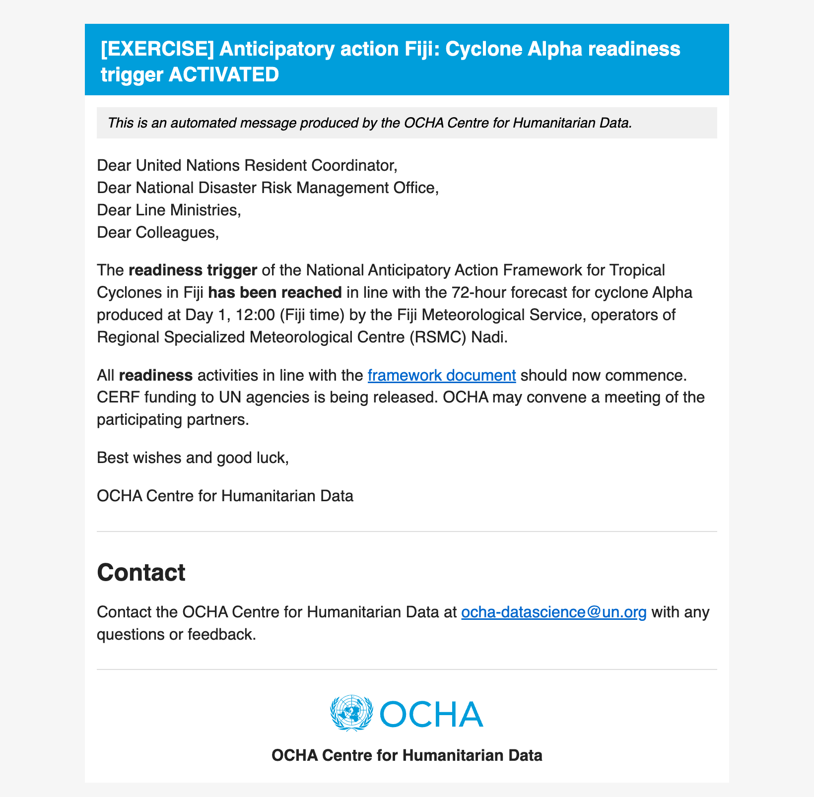
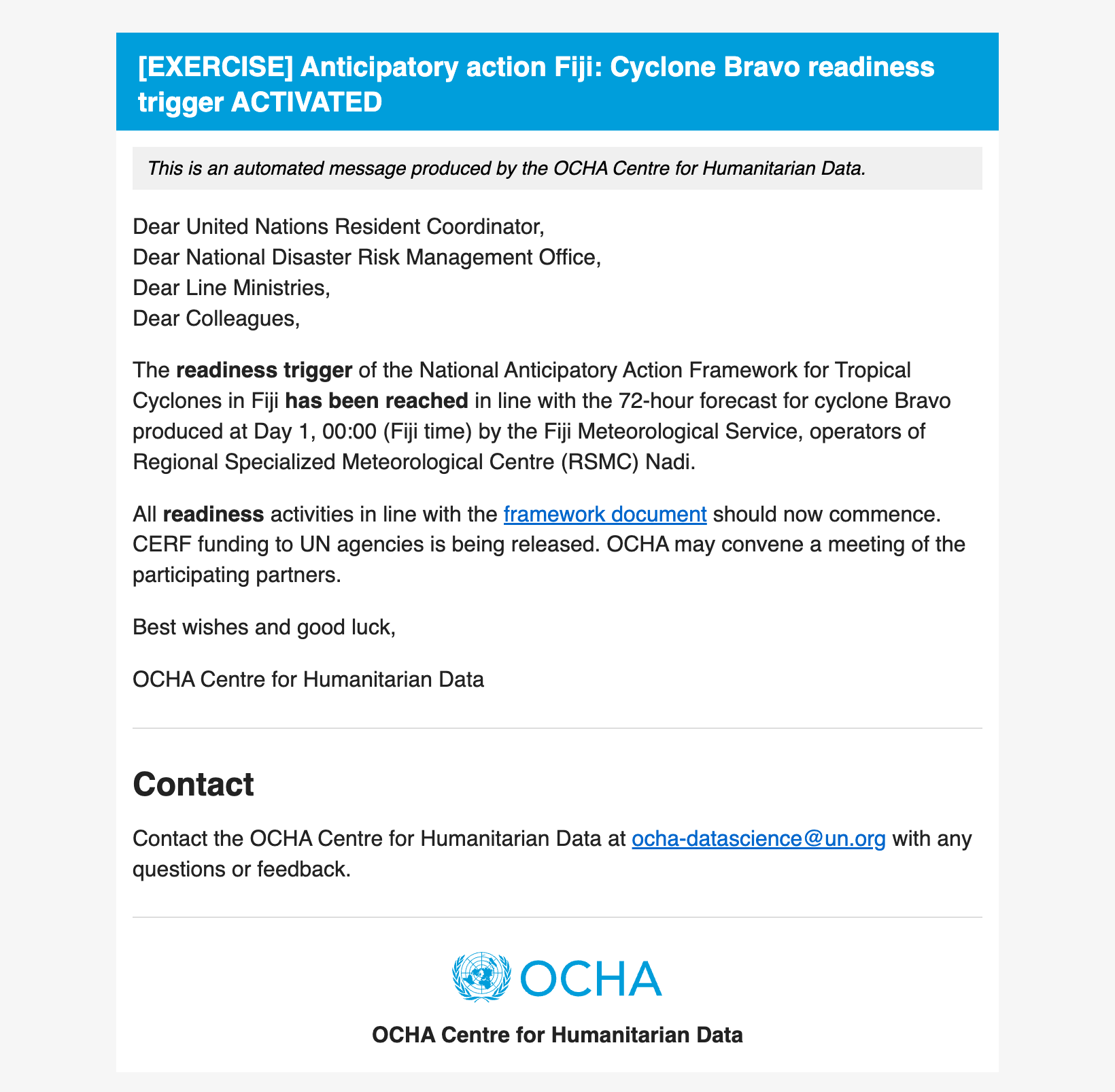
The readiness trigger email
As soon as the forecast is checked, the monitoring system sends an email like this automatically to the trigger distribution list (framework Annex 4).
Mock-up for the exercise, based on the live email template.
The track holds. Within the next 72 hours, hurricane-force winds now reach the Yasawa Group: 3,901 people — just below the 5,000 threshold. Readiness is already activated; action is not reached yet.
| Trigger | This forecast | Status |
|---|---|---|
| Readiness120-hour forecast |
637,137 people in 64-kt zone
threshold 5,000
|
✓ ActivatedDay 1, 12:00 |
| Action72-hour forecast |
3,901 people in 64-kt zone
threshold 5,000
|
Not reached |
| Observational2-day rainfall | IMERG satellite, checked daily | — |
Landfall is now about three days away: 658,281 people are in the 64-kt zone within the 72-hour forecast.
| Trigger | This forecast | Status |
|---|---|---|
| Readiness120-hour forecast |
678,500 people in 64-kt zone
threshold 5,000
|
✓ ActivatedDay 1, 12:00 |
| Action72-hour forecast |
658,281 people in 64-kt zone
threshold 5,000
|
ACTIVATED |
| Observational2-day rainfall | IMERG satellite, checked daily | — |
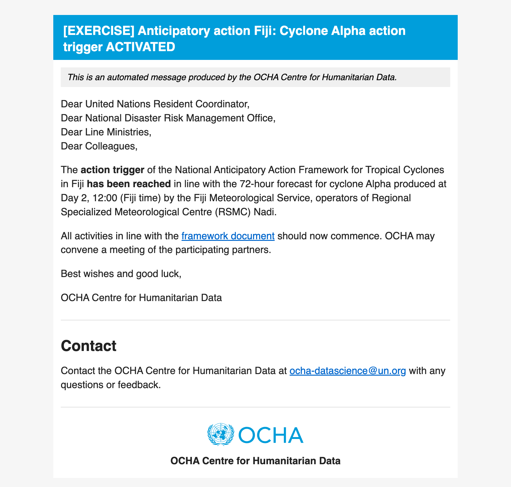
The action trigger email
As soon as the forecast is checked, the monitoring system sends an email like this automatically to the trigger distribution list (framework Annex 4).
Mock-up for the exercise, based on the live email template.
Alpha is a Category 4 cyclone, about a day and a half from landfall on Viti Levu. Both forecast triggers have already activated. RSMC Nadi forecasts keep coming, and OCHA keeps sending a forecast information email for each one.
| Trigger | This forecast | Status |
|---|---|---|
| Readiness120-hour forecast |
678,270 people in 64-kt zone
threshold 5,000
|
✓ ActivatedDay 1, 12:00 |
| Action72-hour forecast |
678,270 people in 64-kt zone
threshold 5,000
|
✓ ActivatedDay 2, 12:00 |
| Observational2-day rainfall | IMERG satellite, checked daily | — |
Cyclone Bravo, north of Fiji, is forecast to strengthen to Category 4 and pass over Vanua Levu in about four days. 32,817 people are in the 64-kt zone of the 120-hour forecast, all beyond 72 hours.
| Trigger | This forecast | Status |
|---|---|---|
| Readiness120-hour forecast |
32,817 people in 64-kt zone
threshold 5,000
|
ACTIVATED |
| Action72-hour forecast |
0 people in 64-kt zone
threshold 5,000
|
Not reached |
| Observational2-day rainfall | IMERG satellite, checked daily | — |
The readiness trigger email
As soon as the forecast is checked, the monitoring system sends an email like this automatically to the trigger distribution list (framework Annex 4).
Mock-up for the exercise, based on the live email template.
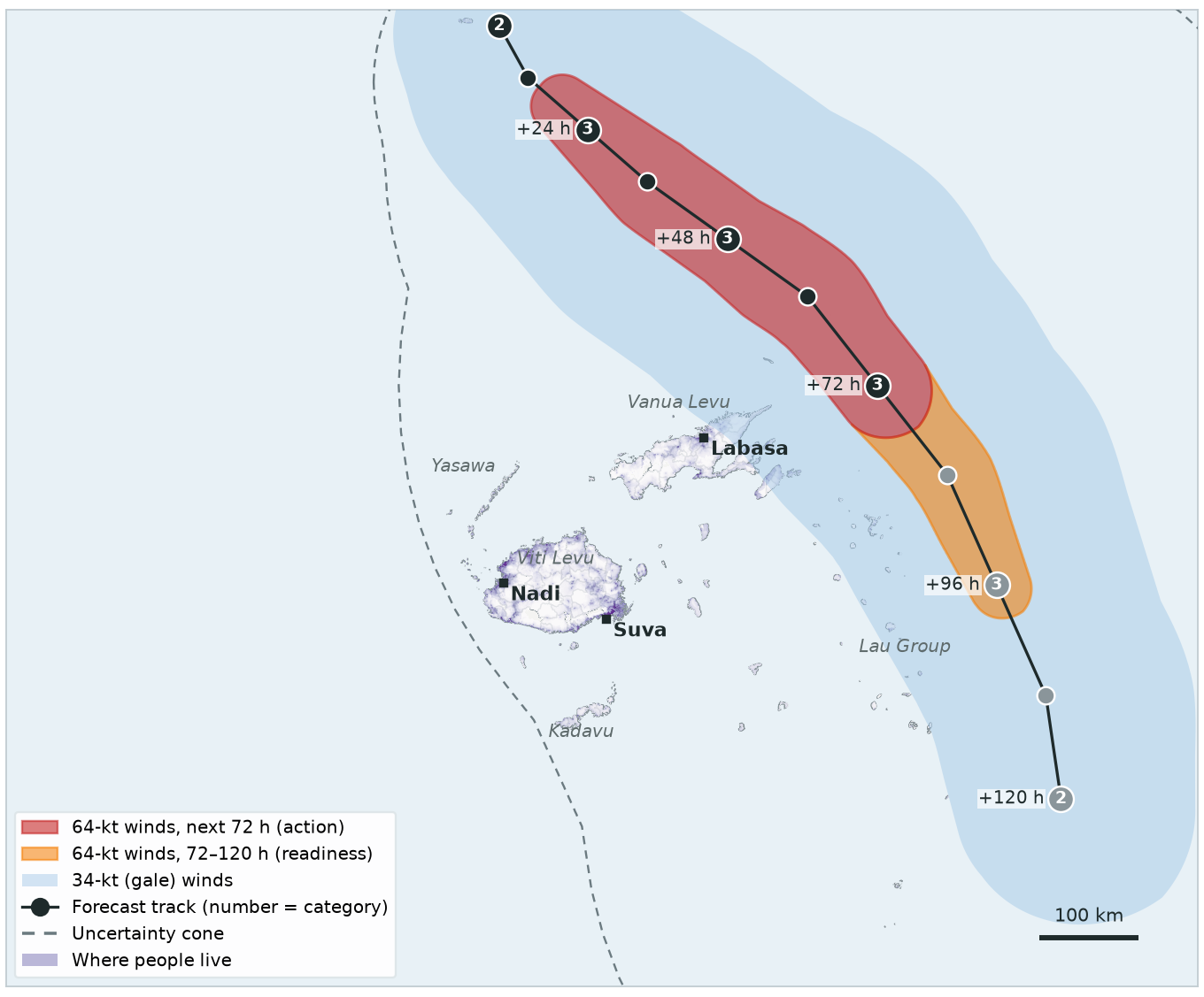
The forecast shifts east: hurricane-force winds now pass about 20 km from land, so nobody is in the 64-kt zone. Readiness stays activated.
| Trigger | This forecast | Status |
|---|---|---|
| Readiness120-hour forecast |
0 people in 64-kt zone
threshold 5,000
|
✓ ActivatedDay 1, 00:00 |
| Action72-hour forecast |
0 people in 64-kt zone
threshold 5,000
|
Not reached |
| Observational2-day rainfall | IMERG satellite, checked daily | — |
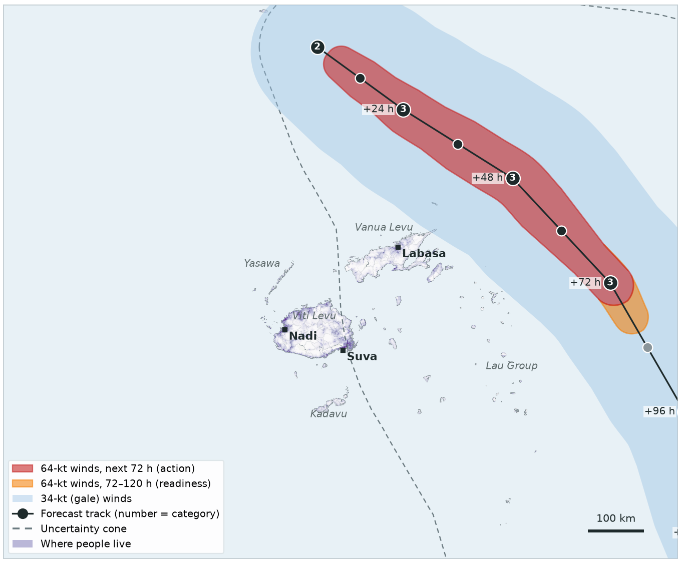
Bravo is now forecast to curve south-east, away from Fiji. The 64-kt winds stay 65 km offshore.
| Trigger | This forecast | Status |
|---|---|---|
| Readiness120-hour forecast |
0 people in 64-kt zone
threshold 5,000
|
✓ ActivatedDay 1, 00:00 |
| Action72-hour forecast |
0 people in 64-kt zone
threshold 5,000
|
Not reached |
| Observational2-day rainfall | IMERG satellite, checked daily | — |
Further east again: the closest hurricane-force winds are 85 km from land. The action threshold is not reached.
| Trigger | This forecast | Status |
|---|---|---|
| Readiness120-hour forecast |
0 people in 64-kt zone
threshold 5,000
|
✓ ActivatedDay 1, 00:00 |
| Action72-hour forecast |
0 people in 64-kt zone
threshold 5,000
|
Not reached |
| Observational2-day rainfall | IMERG satellite, checked daily | — |
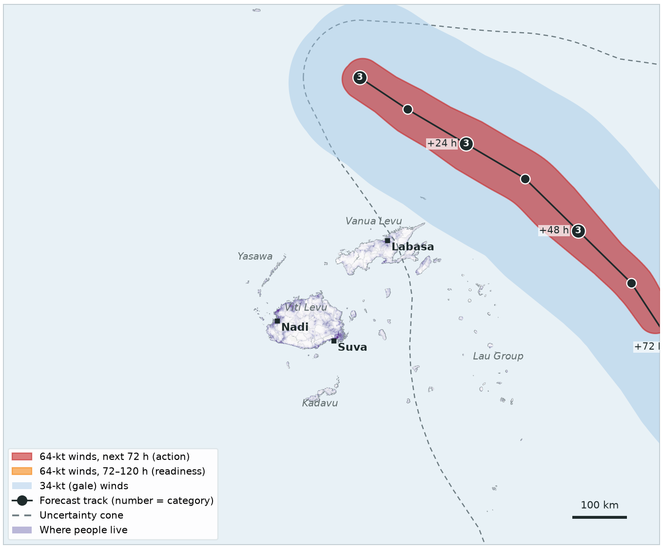
Bravo passes east of the Lau Group, its centre 140 km from land at the closest. Its hurricane-force winds stay 90 km offshore.
| Trigger | This forecast | Status |
|---|---|---|
| Readiness120-hour forecast |
0 people in 64-kt zone
threshold 5,000
|
✓ ActivatedDay 1, 00:00 |
| Action72-hour forecast |
0 people in 64-kt zone
threshold 5,000
|
Not reached |
| Observational2-day rainfall | IMERG satellite, checked daily | — |
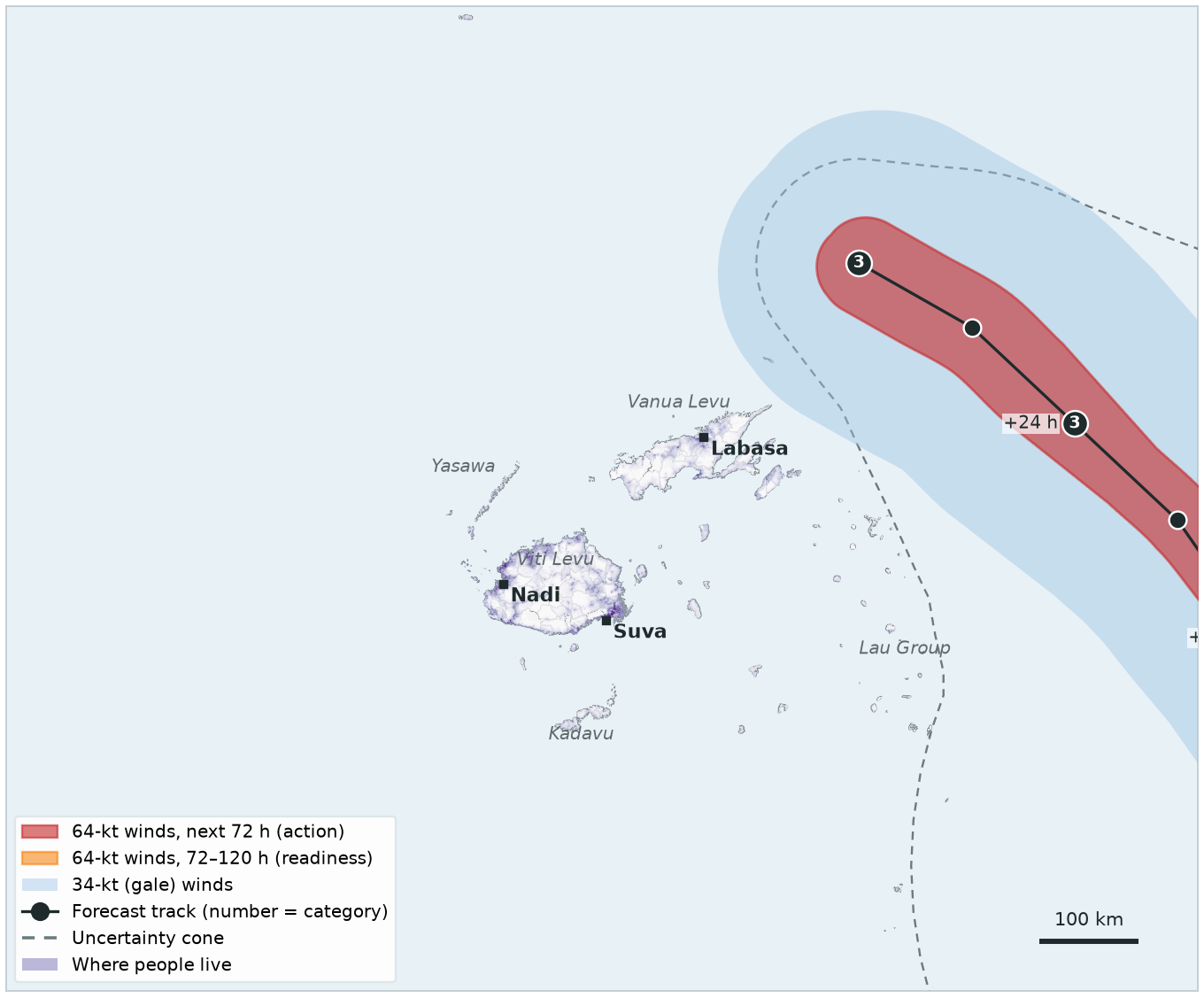
Satellite rainfall for Days 3 and 4, while Bravo was within 250 km of Fiji: 5 mm averaged over the whole country — far below 190 mm. Nothing more activates for this storm.
| Trigger | This rainfall check | Status |
|---|---|---|
| Readiness120-hour forecast | — | ✓ ActivatedDay 1, 00:00 |
| Action72-hour forecast | — | Not reached |
| Observational2-day rainfall |
5 mm country average
threshold 190 mm
|
Not reached |
Storm centre within 250 km of Fiji during these days (±1 day): ✓ (closest 115 km). Rainfall here is invented for the exercise.
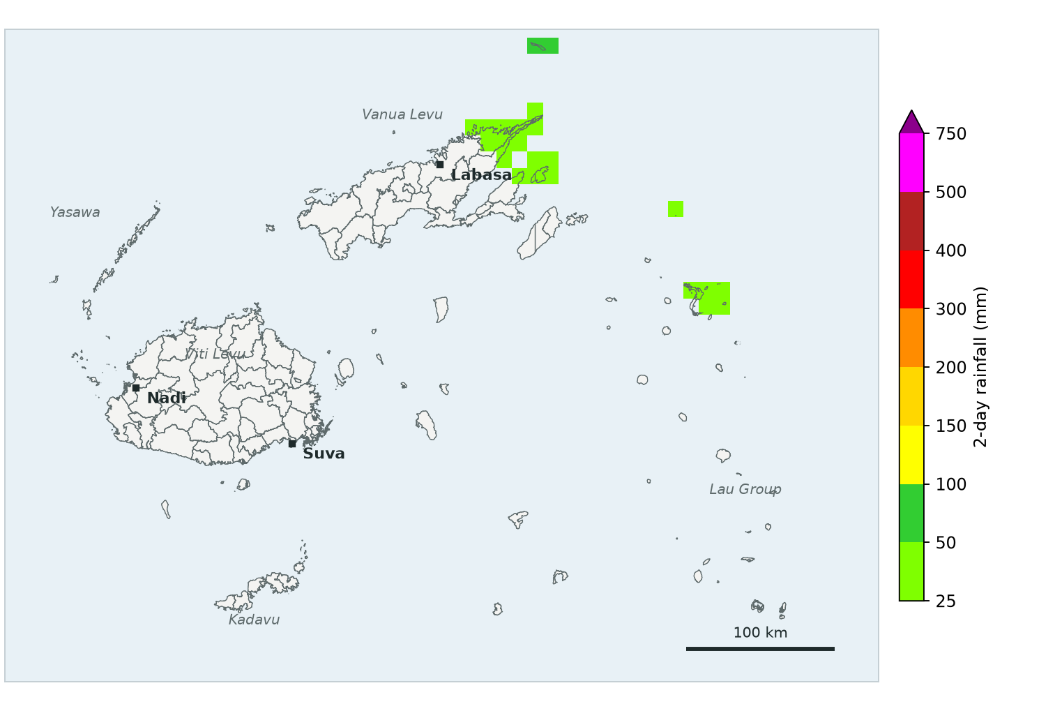
Cyclone Charlie, west of Fiji, is forecast to move slowly across Viti Levu — but only as a Category 2. No hurricane-force winds are forecast, so nobody is in the 64-kt zone.
| Trigger | This forecast | Status |
|---|---|---|
| Readiness120-hour forecast |
0 people in 64-kt zone
threshold 5,000
|
Not reached |
| Action72-hour forecast |
0 people in 64-kt zone
threshold 5,000
|
Not reached |
| Observational2-day rainfall | IMERG satellite, checked daily | — |
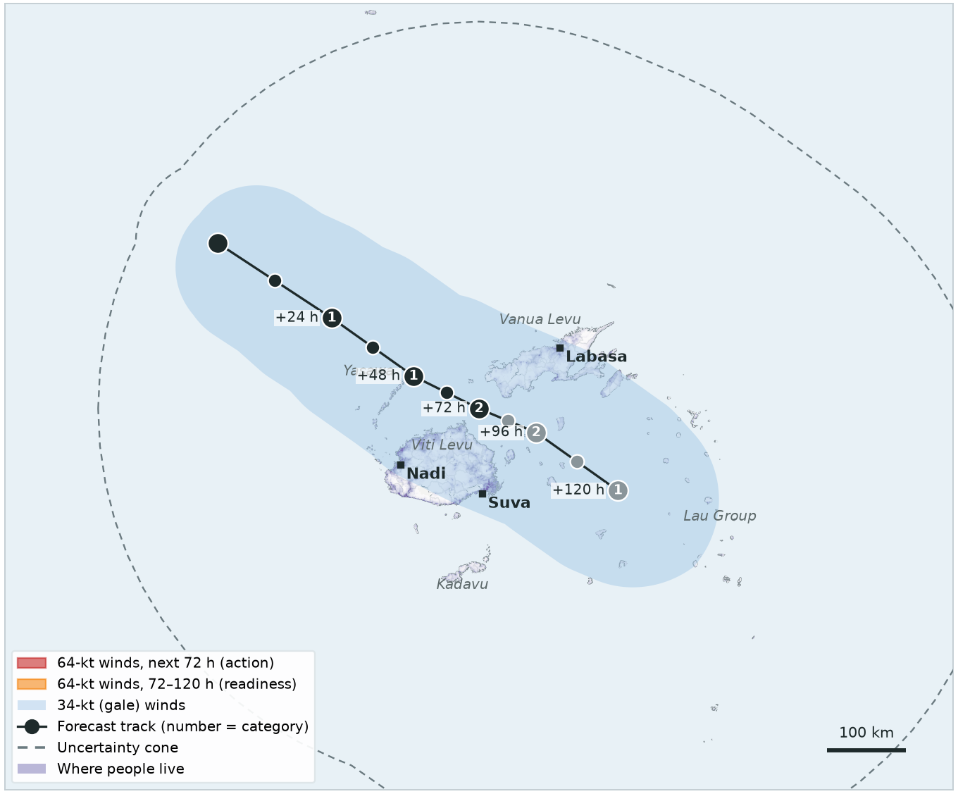
Charlie is slowing down. Gale-force winds are forecast over most of Viti Levu (719,509 people in the 34-kt zone) for the next two to three days — but still no 64-kt winds.
| Trigger | This forecast | Status |
|---|---|---|
| Readiness120-hour forecast |
0 people in 64-kt zone
threshold 5,000
|
Not reached |
| Action72-hour forecast |
0 people in 64-kt zone
threshold 5,000
|
Not reached |
| Observational2-day rainfall | IMERG satellite, checked daily | — |
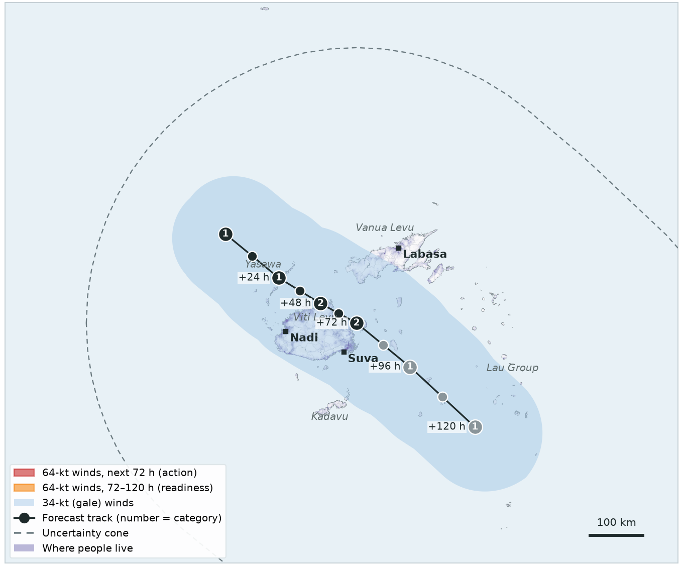
Charlie is almost stationary over western Viti Levu, with very heavy rain. The forecast triggers only look at 64-kt winds, so they do not activate.
| Trigger | This forecast | Status |
|---|---|---|
| Readiness120-hour forecast |
0 people in 64-kt zone
threshold 5,000
|
Not reached |
| Action72-hour forecast |
0 people in 64-kt zone
threshold 5,000
|
Not reached |
| Observational2-day rainfall | IMERG satellite, checked daily | — |
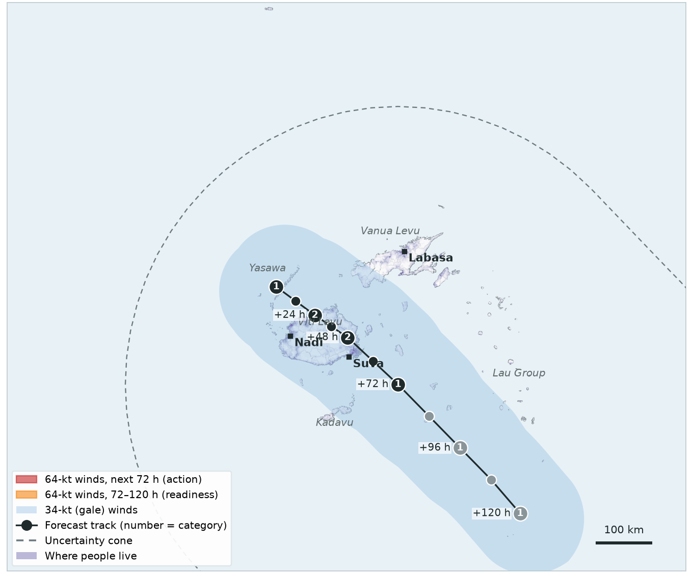
Still Category 2, still no 64-kt winds forecast. For this storm, it is the rainfall that matters.
| Trigger | This forecast | Status |
|---|---|---|
| Readiness120-hour forecast |
0 people in 64-kt zone
threshold 5,000
|
Not reached |
| Action72-hour forecast |
0 people in 64-kt zone
threshold 5,000
|
Not reached |
| Observational2-day rainfall | IMERG satellite, checked daily | — |
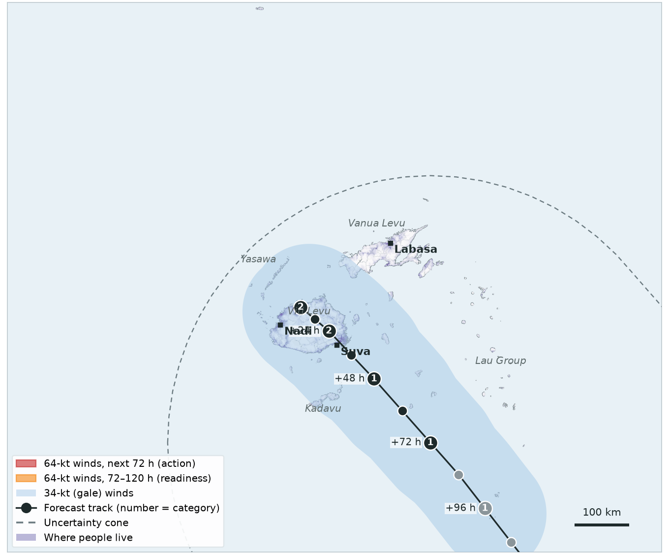
Rainfall check covering Days 2 and 3: 125 mm averaged over the whole country. Very heavy in places (up to 280 mm), but the country average is below 190 mm.
| Trigger | This rainfall check | Status |
|---|---|---|
| Readiness120-hour forecast | — | Not reached |
| Action72-hour forecast | — | Not reached |
| Observational2-day rainfall |
125 mm country average
threshold 190 mm
|
Not reached |
Storm centre within 250 km of Fiji during these days (±1 day): ✓ (closest 0 km). Rainfall here is invented for the exercise.
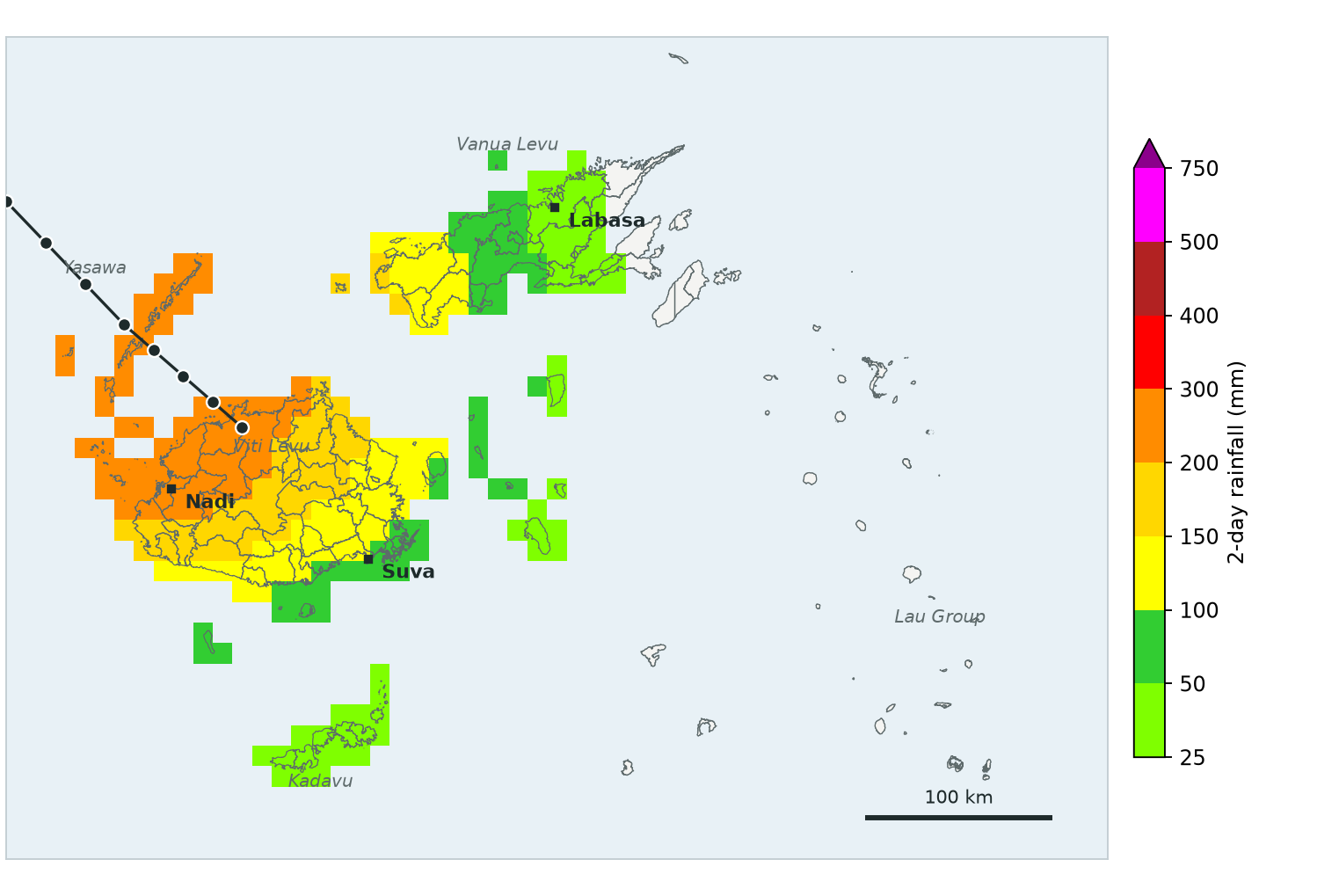
Satellite rainfall for Days 3 and 4, with Charlie's centre over Viti Levu: 210 mm averaged over the whole country (up to 380 mm locally). That is above 190 mm.
| Trigger | This rainfall check | Status |
|---|---|---|
| Readiness120-hour forecast | — | Not reached |
| Action72-hour forecast | — | Not reached |
| Observational2-day rainfall |
210 mm country average
threshold 190 mm
|
ACTIVATED |
Storm centre within 250 km of Fiji during these days (±1 day): ✓ (closest 0 km). Rainfall here is invented for the exercise.
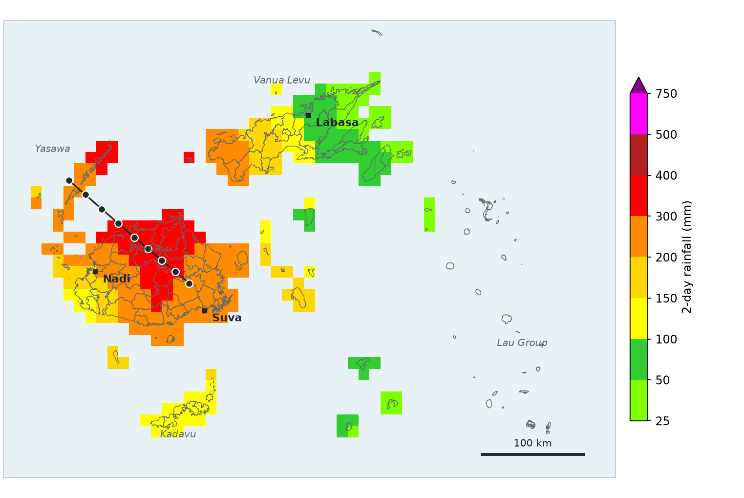
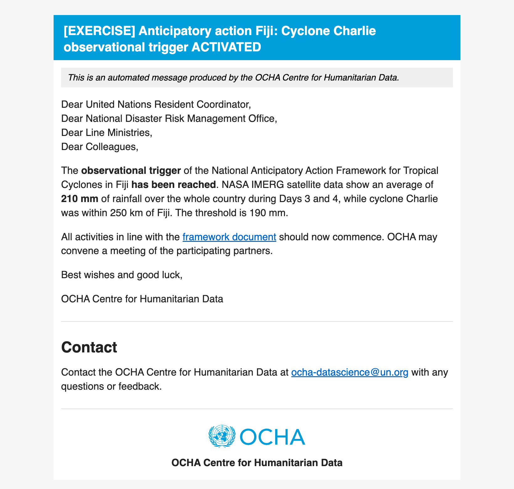
The observational trigger email
At the daily rainfall check, the monitoring system sends an email like this automatically to the trigger distribution list (framework Annex 4).
Mock-up for the exercise.